JOURNAL OF A TOUR OF DISCOVERY ACROSS THE BLUE MOUNTAINS, in the year 1813, by Gregory Blaxland
On Sunday they rested, and arranged their future plan. They had reason, however, to regret this suspension of their proceedings, as it gave the men leisure to ruminate on their danger; and it was for some time doubtful whether, on the next day, they could be persuaded to venture farther. 14 The dogs this day killed two small kangaroos. They barked and ran off continually during the whole night; and at day-light, a most tremendous howling of native dogs was heard, who appeared to have been watching them during the night.
On Monday, the 17th, having laden the horses with as much grass as could be put on them, in addition to their other burdens, they moved forward along the path which they had cleared and marked, about six miles and a half. The bearing of the route they had been obliged to keep along the ridge, varied exceedingly; it ran sometimes in a north-north-western direction — sometimes south-east, or due south, but generally south-west, or south-south-west. 15 They encamped in the afternoon between two very deep gulleys, on a narrow bridge, Grose Head bearing north-east by north; and Mount Banks north-west by west. They had to fetch water up the side of the precipice, about six hundred feet high, and could get scarcely enough for the party. 16 The horses had none this night; they performed their journey well, not having to stand under their loads.
 The following day was spent in cutting a passage through the brushwood, for a mile and a half further. They returned to their camp at five o'clock, very much tired and dispirited. The ridge, which was not more than fifteen or twenty yards over, with deep precipices on each side, was rendered almost impassable by a perpendicular mass of rock, nearly thirty feet high, extending across the whole breadth, with the exception of a small broken rugged track in the centre. By removing a few large stones, they were enabled to pass. 17
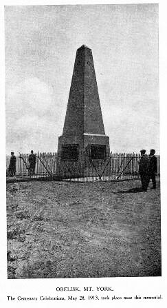
On Wednesday, the 19th, the party moved forward along this path; bearing chiefly west, and west-south-east. They now began to ascend the second ridge 18 of the mountains, and from this elevation they obtained for the first time an extensive view of the settlements below. Mount Banks bore north-west; Grose Head, north-east; Prospect Hill, east by south; the Seven Hills, east-north-east; Windsor, northeast by east. At a little distance from the spot at which they began the ascent, they found a pyramidical heap of stones 19, the work, evidently, of some European, one side of which the natives had opened, probably in the expectation of finding some treasure deposited in it. This pile they concluded to be the one erected by Mr. Bass, to mark the end of his journey. 20 That gentleman attempted, some time ago, to pass the mountains, and to penetrate into the interior; but having got thus far, he gave up the undertaking as impracticable; reporting, on his return, that it was impossible to find a passage even for a person on foot. Here, therefore, the party had the satisfaction of believing that they had penetrated as far as any European had been before them.
They encamped this day to refresh their horses, at the head of a swamp covered with a coarse rushy grass, with a small run of good water through the middle of it. 21 In the afternoon, they left their camp to mark and cut a road for the next day.

